Google Maps - A Useful Tool for an Elusive Dog
- lostdogswi
- Jun 3, 2012
- 3 min read
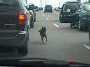
You’ve lost your shy dog and you’ve done a good job delivering flyers and posting intersection signs. Now your sightings are coming in but you’re having a hard time keeping track. The sightings seem to be all over the place. It couldn’t possibly be your dog, in so many places, in such a short amount of time. Or could it?
Lost dogs in survival mode require three things. They require food and water, hiding places, and avoidance of predators (people). If you use maps and satellite photos to assess food sources, hiding places and safe, secluded routes of travel; you may start to see a pattern emerge. Using an online mapping service is an invaluable tool to help you record and evaluate your sightings.
Google Maps is a free web mapping service that can help you plot your sightings and give you clues to your dog’s whereabouts. Be aware though, that Google maps and satellite images are not updated in real time, they could be several months or years old. New construction may not appear on the maps and photos. Buildings and landscapes change and you will have to take that into consideration. Photos are taken during different seasons. Summer photos will appear very different from photos taken in the same area in the autumn after the leaves have fallen.
Different areas of the country have satellite photos taken at different resolutions. Generally, the more populated the area – the better the photo, and the closer that you will be able to zoom in and see detail. Many urban and suburban areas also now have Street View – a setting that lets you see buildings and landmark features as if you were standing on the ground in front of them.
This blog isn’t a tutorial on how to use Google maps. There is plenty of information on-line. Instead, we want to give you some specific tips on how to determine where your dog may be. The best way to learn how to use Google Maps is to dive in and try it. Enter the address where your dog went missing from. Practice changing from map to satellite (aerial photo) view, and zooming in and out.
Practice adding place markers for the following. Use different colors and symbols for:
Locations where your dog went missing from
Every sighting with a time and date
Areas flyered
Sign locations
Potential food sources
Potential hiding places
Potential routes that your dog is travelling
Switch to satellite view. Objects viewed from the air appear different from the ground. Practice somewhere you are familiar with. What do these things look like from the air?
Common landmarks:
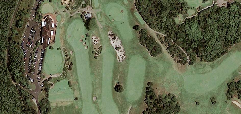
A golf course:
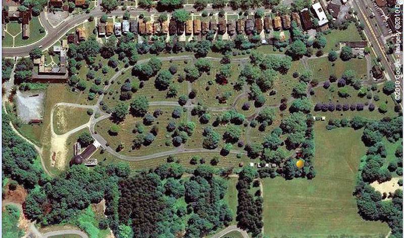
A cemetery:
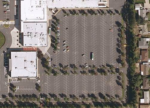
A shopping mall:
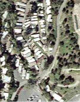
A mobile home park:
Vertical landmarks from the ground may not be easily apparent on a satellite photo.
Watch for the shadows made by the objects. Vertical landmarks include:
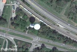
Water towers
Power lines
Church steeples
Cell phone towers
Tall buildings
Doppler radar sites
A water tower in satellite imagery. It looks like a golf ball, but notice the shadow that it casts
Look for possible hiding places that lost dogs commonly use:
abandoned farms and homes
cemeteries
golf courses
parks near populated areas
industrial areas
run down neighborhoods
quiet suburban neighborhoods especially if they adjoin parks and trails
Look for possible routes of travel that lost dogs commonly use:
bike and hiking trails
fence lines and the edge of fields
logging roads
power lines
pipelines and cut lines
railroad tracks
Be aware that narrow roads, trails, and power lines may “disappear” in summer photos because of tree foliage. Railroad tracks are usually very apparent in photos because of the width of clearing around the track bed. Trees do not usually overhang train tracks.
Look for possible food sources:
restaurants and hotels
farms (cat food, corn and spilled grain)
convenience stores and grocery stores
campgrounds, picnic grounds, rest stops and parks
golf courses with food services
food processing plants
feed mills
Keep your Google map updated and share it via email link with the friends, family and volunteers that are helping you. Lost dogs will often fall into an habitual pattern, visiting the same food sources and using the same hiding places and routes of travel. Flyer these areas heavily to get more sightings. Place intersection signs strategically so that passersby will also be on the lookout for your dog.
You may realize that sightings that seemed impossible at first, really are possible when you view them from the air. Driving routes are often much longer than the routes that lost dogs will take. Using shortcuts, they can travel what appears to be a long distance in a short amount of time.
Advances in technology are giving us more and more tools in the toolbox of lost dog recovery. Using Google Maps can save you valuable time when recovering your lost dog.